


Ten Cool Facts About Baffin Island
Some info about Canada's largest island

A very noticeable part of the Canadian map, and the largest island in the country, Baffin Island is a place most Canadians will recognize, but a place that very few Canadians will ever visit or live.
The island has been an important place for the Inuit, who call it ᕿᑭᖅᑖᓗᒃ, or Qikiqtaaluk in English. Its name means Very Big Island in Inuktitut.
So, let’s learn a bit about this massive island!
Not only is it the largest island in Canada at 507,451 square-kilometres, but it is also the fifth-largest island in the entire world.
The island is named for William Baffin. Baffin attempted to find a route for the Northwest Passage and made several explorations of the Arctic area.
The Norseman are believed to have landed at the island around 1000 AD and called it Helluland, or Flat-Rock Land. It is mentioned in the Icelandic sagas and was an important point between Greenland and Newfoundland for the Norse.
About 11,000 people live on Baffin Island and almost all of them live in Iqaluit, the capital city of the territory of Nunavut.
Snow can fall all year on Baffin Island and the average annual temperature for the island is about -8 degrees Celsius.
In some areas of Baffin Island, like Clyde River, the sun does not set for two months in the summer time, and doesn't rise for two months in the winter.
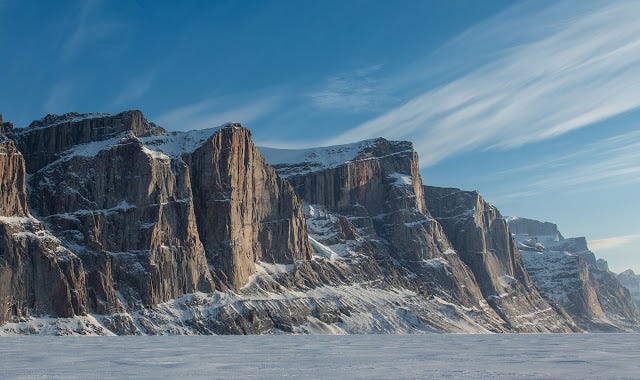
Baffin Island is home to two national parks and a well-known bird sanctuary. The national parks include the high mountain peaks in the south and the Penny Ice Cap.
Cape Dorset, located in the southwest of the island, has been inhabited for over 1,000 years.
While it may be in the far north, Baffin Island actually has an abundance of wildlife including arctic wolves, arctic foxes, caribou, lemming and polar bears. Beluga whales are also found in the waters surrounding it.
For decades, Baffin Island was part of the Northwest Territories but in 1999, it became part of the newly formed Nunavut territory.